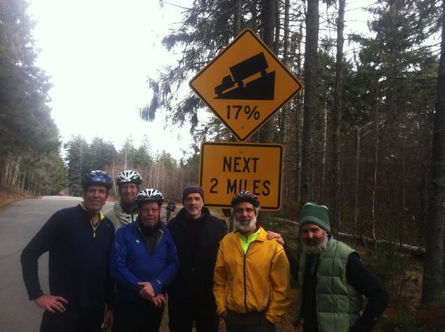
 Hurricane Mountain Road summit, November 2013. Left to right: Bruce Davis, Jon Vara, Mark Bromley, Lee Burnett, David Bayne, Chris Tormey. Out-of-the-picture photographer: Bill "William the Recumbent" Birchard.
 Northern New England has a lot of steep mountain roads. The toughest of them is the Mount Washington Auto Road in New Hampshire, which climbs nearly 5,000 feet in less than 8 miles, for an average grade of about 12 percent. I’ve never attempted it, because the road is only open to bicycles two days a year, and then only to racers who have coughed up a $350 entry fee.
I did once ride up Vermont's Mt. Ascutney, which gains almost exactly half the elevation of Mt. Washington in almost exactly half the distance. The Ascutney ride is popular with people training for the Mt. Washington race because it’s open to anyone for the cost of a day pass to Ascutney State Park. (Vermont state motto: Freedom and Unity. New Hampshire state motto: Charge Fees or Die.)
I did once ride up Vermont's Mt. Ascutney, which gains almost exactly half the elevation of Mt. Washington in almost exactly half the distance. The Ascutney ride is popular with people training for the Mt. Washington race because it’s open to anyone for the cost of a day pass to Ascutney State Park. (Vermont state motto: Freedom and Unity. New Hampshire state motto: Charge Fees or Die.)
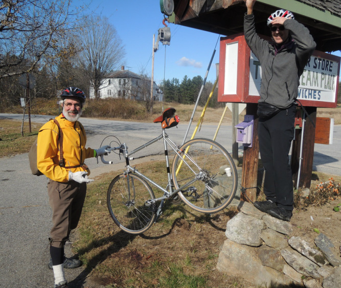 Technically, the scale at the store was for weighing deer (note the bloody patch on the ground). But no one said you couldn't also use it to weigh bikes. Bill's recumbent--that's him shading his eyes at right--was the second-heaviest.
 But both roads, and several others like them, dead-end at their respective summits. The steepest road I know of that actually goes anywhere is the Hurricane Mountain Road, which runs from the vicinity of West Fryburg, Maine to Intervale, New Hampshire. Whether you ride it from east to west or west to east, it climbs something like 1,200 feet in about two miles. That’s a little less steep than Ascutney or Washington, but not by much. There are sustained stretches of 17% grade.
In the middle of November, I got together with a group of old friends to do an end-of-the season overnight including some big hills. The plan called for leaving cars at a campground on Maine Rte. 113—which runs along the Maine-NH line, and crosses into New Hampshire in a couple of places—and ride south through rolling country to the base of the Hurricane Mountain Road. After crossing it, our plan was to head north on Rte. 302 and 16 to an overnight stay the Appalachian Mountain Club camp in Pinkham Notch. On Sunday morning, we’d continue north to Gorham and head east on Rte. 2 before picking up 113 again and following it up and over Evans Notch and back to our vehicles.
In the middle of November, I got together with a group of old friends to do an end-of-the season overnight including some big hills. The plan called for leaving cars at a campground on Maine Rte. 113—which runs along the Maine-NH line, and crosses into New Hampshire in a couple of places—and ride south through rolling country to the base of the Hurricane Mountain Road. After crossing it, our plan was to head north on Rte. 302 and 16 to an overnight stay the Appalachian Mountain Club camp in Pinkham Notch. On Sunday morning, we’d continue north to Gorham and head east on Rte. 2 before picking up 113 again and following it up and over Evans Notch and back to our vehicles.
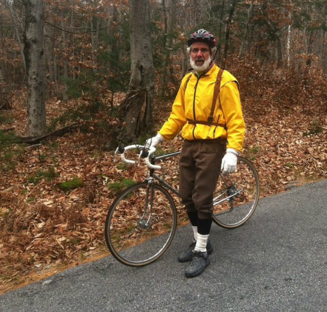 A vintage Motobecane, wool knickers, and a Swedish Army surplus rucksack, circa 1939. Can it get any better than this?
 The weather was about as good as you could reasonably hope for at that time of year—mostly clear, not much wind, with temperatures in the mid-to-high 30s. We reached the base of the Hurricane Mountain Road around noon and began clawing our way up and over.
As an oldish guy who lives at the top of a long, steep stretch of dirt road, I’m not ashamed to run a mountain-bike-style low gear on my road bikes, and on this trip I was glad to have it. I ground to the top in a 30-tooth chainring and a 34-tooth freewheel cog, with my cadence dropping to 45 rpm on the steepest sections. (Yes, I looked it up when I got home—that's about 3 miles per hour.) I had to keep sliding forward to prevent my front wheel from losing contact with the pavement.
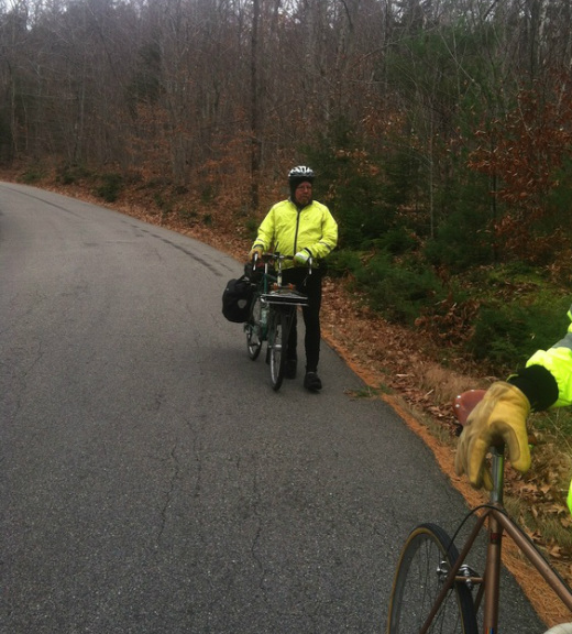 Sometimes it's best to walk parts of the descent, too. Especially if--like Mark here--your bike is loaded down with every steel touring rack, tool, and accessory known to humanity. The whole rig (excluding rider) weighs 58 lbs. We checked.
 Most of the other guys—who, it must be said, weren’t geared as low as I was—ended up walking at least part of the way. No matter. The difference in arrival time between those who walked all the way, those who walked part of the way, and those who rode all the way did no real credit to any of us.
For some reason, the warning sign for the descent of the west side designates it as a 5% grade. Not so—it’s the same 17% as the east side. At two closely-spaced switchbacks along the way, the grade on the inside of the curves looks more like a cliff than a roadway.
I expected to use my brakes a lot, and did use them a lot.
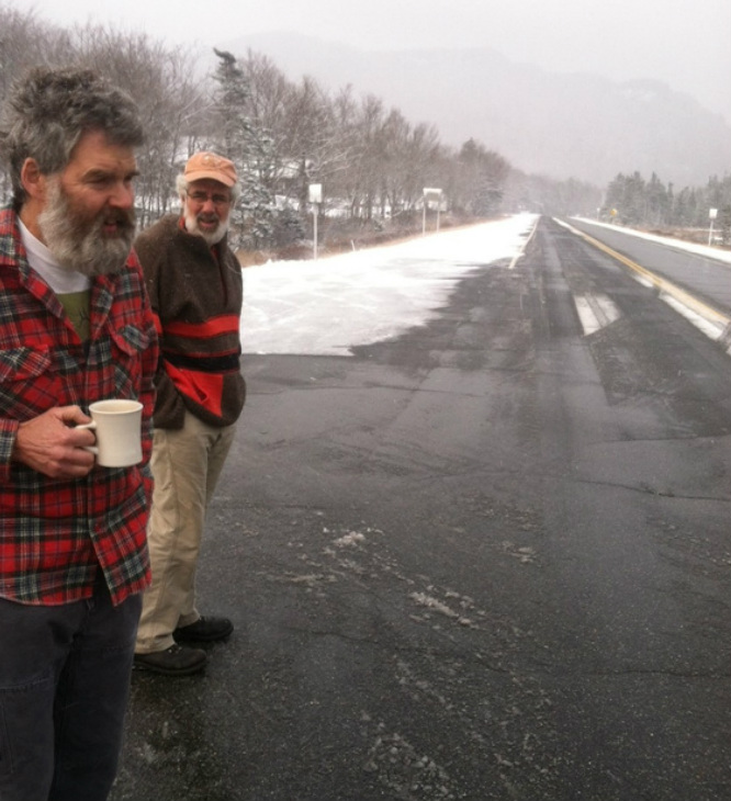 Perfect coffee-drinking weather at Pinkham Notch on Sunday morning. For riding, not so much.
 At the bottom, we ate slices of pizza and and drank bottles of Moxie before turning north, with fifteen miles and a thousand-foot climb still ahead of us. A few pesky mechanical issues surfaced at around this point: Chris broke a derailleur cable, and for lack of a spare had to ride the rest of the route on his 15-tooth cog. I developed a pedal problem (caused, I later found, by the near-simultaneous loss of one SPD cleat screw on each of my shoes) that prevented me from unclipping my right foot or clipping in with my left. On average it was fine. We reached the Notch in fading daylight and spitting snow.
After a pleasant and sociable evening—the ride had been planned to coincide with the annual meeting of the AMC Trail Crew Association—we woke on Sunday morning to three inches of fresh snow. Out with Plan A, in with Plan B. We caught a ride back to our vehicles and declared victory. That's the way to run a bike tour.
After a pleasant and sociable evening—the ride had been planned to coincide with the annual meeting of the AMC Trail Crew Association—we woke on Sunday morning to three inches of fresh snow. Out with Plan A, in with Plan B. We caught a ride back to our vehicles and declared victory. That's the way to run a bike tour.
 RSS Feed